A note from Deborah. Read her editorial perspective
Killary Fjord has been selected as one of Lonely Planet's Best in Travel 2027 experiences, and the news feels both overdue and slightly dangerous. Overdue because this long Atlantic inlet, pressed between Connemara and Mayo, has the scale and silence people travel west to find. Dangerous because recognition can turn a place into a stop, and Killary is diminished when it becomes a photograph between Kylemore Abbey and Westport. Our view is simple: Lonely Planet chose the right place. To understand why, you need to give it more than the ten minutes most itineraries allow.
Why the Best in Travel 2027 recognition matters
RTÉ reported on 23 September 2026 that Killary Fjord had been chosen for Lonely Planet's Best in Travel 2027 list. The selection places it among the experiences the publisher believes travellers should seek in the coming year. This distinction matters. Killary was not awarded a generic badge for being photogenic. It was recognised as something to do and feel, which is closer to the truth of the place. The water changes with the tide, cloud travels across Mweelrea, and the road reveals the inlet in fragments. You do not consume Killary in one view.
The timing also says something about travel in Ireland. The best-known western stops are carrying more visitors, more coaches and more pressure. Killary offers another model: a landscape with no single gate, no required pose and no fixed sequence. Lonely Planet's editors described it as seriously overlooked and placed it among experiences suited to travellers seeking fewer crowds and more meaning. We agree with the instinct, but recognition is useful only if it encourages better travel. Arriving, taking a photograph and leaving would repeat the mistake the award has the power to correct.
What earns Killary its place is not novelty. The harbour has supported farms, boats and movement between communities for generations. Its appeal comes from the fact that those practical lives remain visible. Mussel lines mark the sheltered water. Sheep fields descend towards the shore. Leenane sits at the head of the inlet without trying to become a resort. The Ireland Edit view is that the award is deserved precisely because Killary has not been arranged around the visitor. Go before that balance becomes harder to protect.
Killary Fjord, Killary Harbour, Galway or Mayo
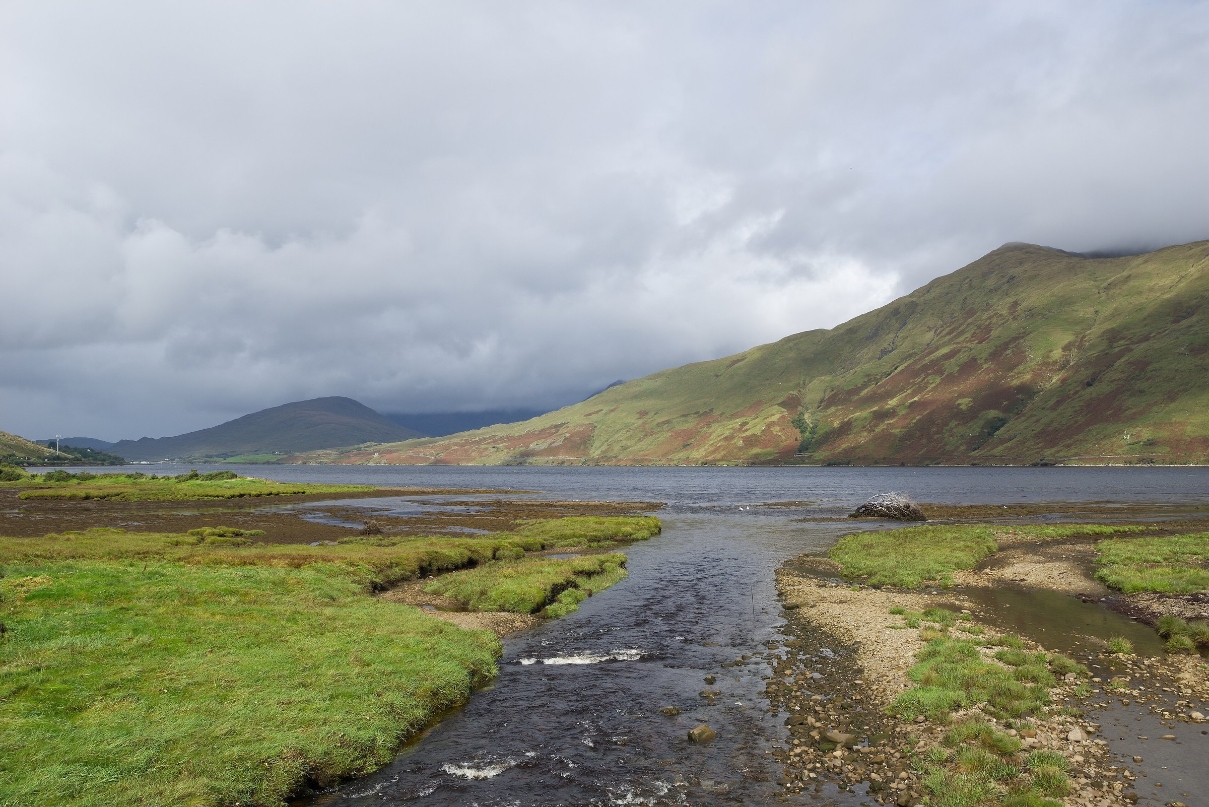
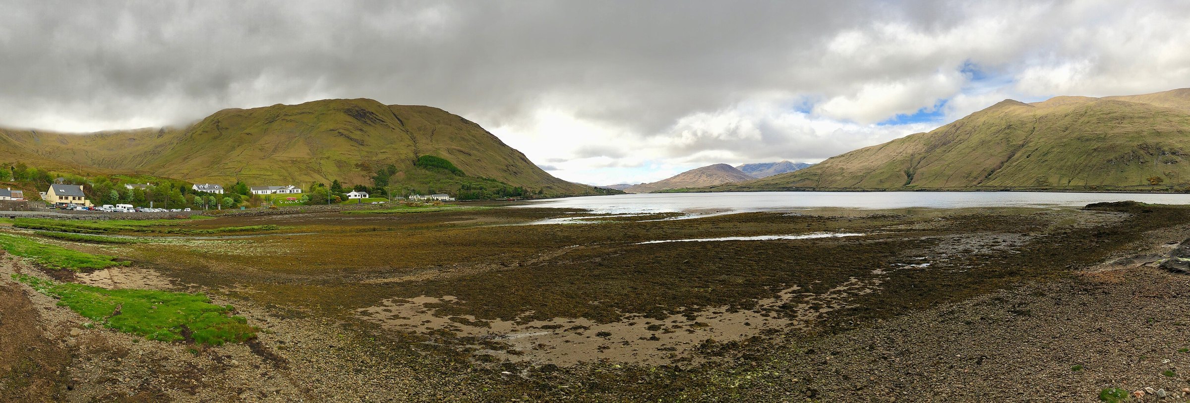
Killary Fjord and Killary Harbour are names for the same body of water. The Irish name is An Caoláire Rua. The inlet runs for roughly sixteen kilometres from the Atlantic towards Leenane, with County Galway on its southern shore and County Mayo on its northern shore. That is why one source places it in Galway and another in Mayo. Both can be geographically honest. Leenane, the village most visitors use as their anchor, is in County Galway. Mweelrea, the mountain dominating the northern side, is in County Mayo.
This border position is not trivia. It explains how Killary fits a trip. From Galway city or Clifden, it is the northern conclusion to a Connemara day. From Westport, it is the southern opening to Mayo. If you are driving between the two, the N59 follows the head of the water at Leenane and makes the fjord almost impossible to miss. The mistake is to treat the convenience of that road as proof that you have seen the place. From the car, you have seen only its narrowest end.
You will also encounter claims that Killary is Ireland's only fjord, one of two fjords, or one of three. Official tourism sources do not agree. The Geological Survey of Ireland gives the firmer description: Killary Harbour is a deep, U-shaped subglacial valley later drowned by the sea, with its deepest central part around forty-five metres. We use the word fjord because it is the established name and the landform is glacial. We do not use the disputed count as a selling point. Killary does not need a numerical superlative.
The right way to see the water
The most revealing first encounter is from the water. Killary Fjord Boat Tours operates a ninety-minute cruise from Nancy's Point, west of Leenane. The route moves into the harbour rather than merely crossing it, changing the proportion of everything around you. Roads disappear. Mweelrea rises directly from the Mayo shore. The Twelve Bens and Maumturk Mountains sit behind the southern side. From the deck, the geology stops being an abstract explanation and becomes the shape enclosing you.
We would book the boat early in the day, then keep the afternoon uncommitted. Conditions govern the experience. Low cloud can erase a summit while leaving the water clear. Rain may pass quickly, or it may settle. Check the operator's current sailing schedule directly because departures are seasonal and weather dependent, and do not build a transatlantic itinerary around the last sailing of the day. The useful practical commitment is ninety minutes on board, plus enough time before and after that you are not watching the clock.
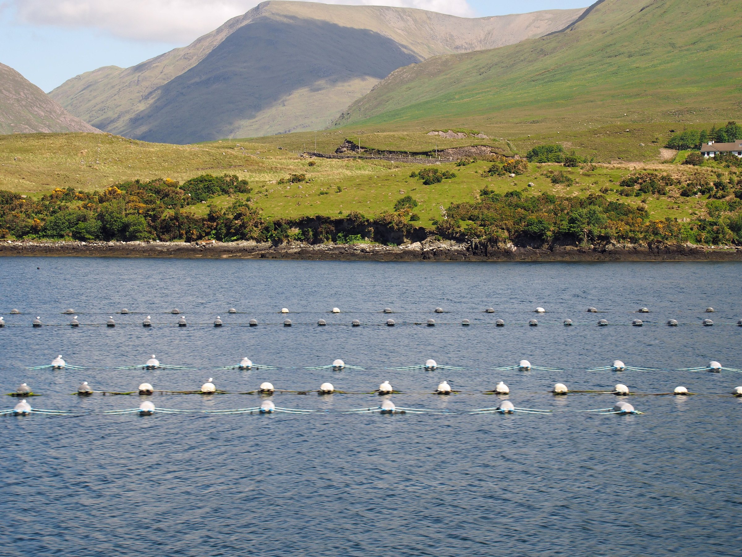
The cruise is not the only valid way to know Killary, and it should not be treated as a theme-park ride. It is a working harbour. Shellfish cultivation is visible in lines and floats across the water, and boats may be moving through their ordinary day. That working texture is part of what we value. Listen to the commentary, but also spend time outside and look back towards Leenane. The finest view is often behind the boat, where the inlet narrows into the folds of the mountains.
Walk the old famine road, not just the lay-by
If the boat gives Killary its scale, the old road gives it time. The Green Road follows part of the southern shore between Rosroe and the vicinity of Leenane. Tourism sources commonly describe the Killary section as roughly nine kilometres. It runs above the water through open ground, passing the remains of settlements and walls that make the landscape feel inhabited even when you meet nobody. The surface and exposure call for walking shoes, a waterproof layer and a plan for transport at the far end.
This is where we would spend the larger part of the day. Walk slowly enough to watch the opposite shore change. From one bend, Mweelrea appears as a wall. From another, the harbour opens towards the Atlantic and the shellfish lines become small marks on a much larger surface. There is little shelter, which is not a flaw to be solved. It is the condition of the walk. If the weather closes completely, shorten the route rather than marching through it to satisfy a schedule.
The name famine road requires more care than travel writing usually gives it. Roads of this period are connected with relief works and the catastrophic social history of the Great Famine. This should not become atmospheric decoration for a holiday photograph. Read the local interpretation, notice the abandoned foundations and leave the stones where they are. Our rule is to walk this shore with attention rather than solemn performance. The history is present whether or not you turn it into content.
Leenane and the hour after everyone leaves
Leenane, also written Leenaun, occupies the head of Killary Harbour where the roads from Clifden, Westport and Joyce Country meet. It is small enough that you can understand its shape in one walk. That does not make it a brief stop. The village works best as a pause between the water and the road, especially once the daytime traffic thins. Have lunch, walk to the edge of the harbour, then decide what the weather is permitting rather than forcing the next attraction.
Aasleagh Falls lies a short drive away on the River Erriff, on the Mayo side of the harbour. It is an easy addition, but parking and roadside conditions can change, so treat it as a short look rather than the centre of the day. Kylemore Abbey is the larger nearby draw in Connemara. It deserves its own time, not a rushed pairing with the fjord. If your itinerary assigns one hurried hour to Killary, Aasleagh, Kylemore and lunch, it has confused proximity with possibility.
We prefer one of two shapes. The active version begins with the Green Road and ends in Leenane. The gentler version takes the morning boat, lunch in the village and a slow drive towards Delphi or Kylemore depending on where you sleep. Both leave room for the hour after the coaches move on. That is when the water darkens, kitchen smoke appears above the village and the road becomes quiet enough to hear the river entering the harbour. Stay for that hour.
When to go and what the weather changes
Late April through June gives Killary long light and a reasonable chance of walking weather before the busiest weeks. September can be equally rewarding, with softer light and fewer day visitors. July and August bring the fullest visitor services and the highest traffic on the western roads. Winter reduces the crowds further, but seasonal sailings, shorter days and exposed paths narrow your options. There is no month in which the weather becomes reliable enough to ignore.
We would not postpone Killary merely because the forecast shows showers. Rain and low cloud often give the harbour its depth. The mistake is arriving without alternatives. Keep the boat and the walk as separate options, carry a proper waterproof and check conditions on the morning itself. Strong wind matters more than a rain symbol. If sailings are cancelled or the shore walk is unpleasant, use the village as the hinge of a driving day and return when the inlet is open again.
For photography, early and late light are useful, but Killary is not dependent on a clear sunset. Side light moving through cloud can divide the mountains into planes that a cloudless noon flattens. The panoramic lay-bys near Leenane are easiest at quieter hours. Pull fully off the road, never stop on a bend, and do not block gates. The view is broad enough to survive a responsible parking choice. You do not need to stand where everyone else has stood.
Where Killary belongs in an Ireland itinerary
Killary belongs in a Connemara and Mayo journey, not in a frantic circuit of the whole island. From a Connemara base, pair it with one northern element: Kylemore, Renvyle or the road through the Maumturks. From Westport, approach through the Delphi Valley and let Killary be the turn towards Leenane. The drive between Clifden and Westport can hold the fjord naturally, but only if you resist filling both ends of the day with fixed admissions.
For a first trip of seven days, we would choose either Connemara or Kerry rather than forcing both. If Connemara wins, give the region at least three nights and reserve one flexible day for Killary. On a ten-day trip, it can connect Galway and Mayo without becoming a detour. It is less convincing as a long day trip from Galway city, where the return drive encourages exactly the rushed behaviour the place resists.
The stay matters because timing matters. A base near Ballynahinch, Kylemore, Renvyle, Leenane or Delphi lets you reach the water before the middle of the day and remain after it. Westport offers more restaurants and a sociable evening, but it places you farther from the southern shore. Galway city is farther again. Choose the room according to the version of Killary you want. We would trade one night in a famous city hotel for one morning here without hesitation.
What we would skip, and why Killary stays
Skip the claim that you have seen Killary because you stopped at the N59 viewpoint. Skip any itinerary that combines the fjord, Kylemore Abbey, Clifden, Westport and Achill in one daylight window. Skip the argument about whether it is the only true fjord in Ireland. None of these choices brings you closer to the place. They turn geography into trivia and distance into achievement.
We would also skip the reflex to chase a blue-sky photograph. Killary's character is built from water, working farms, steep ground and weather. The harbour under a low ceiling of cloud is not a failed version of the harbour. It is often the more legible one. You see how the mountains hold the inlet and why this narrow route between them mattered. Take the photograph, then put the phone away before the light changes again.
Lonely Planet's Best in Travel 2027 recognition will send more people towards Leenane. That is neither inherently good nor inherently bad. The outcome depends on how they arrive. Give Killary a boat journey or a long walk, buy lunch locally, respect the working shore and leave enough room for weather to alter the plan. Do that and the award becomes an invitation to attention rather than another pin on the map. Killary deserves the attention. It also deserves the time.
Questions we get asked
- Where is Killary Fjord in Ireland?
- Killary Fjord lies on the border of County Galway and County Mayo in the west of Ireland. Leenane, at the head of the harbour, is in County Galway, while Mweelrea and much of the northern shore are in County Mayo.
- Are Killary Fjord and Killary Harbour the same place?
- Yes. Killary Fjord and Killary Harbour refer to the same glacial sea inlet. Its Irish name is An Caoláire Rua.
- Is Killary Ireland's only fjord?
- The claim is disputed. Official tourism sources variously describe Ireland as having one, two or three fjords. The Geological Survey of Ireland describes Killary as a deep U-shaped subglacial valley drowned by the sea. We use its established fjord name without presenting the count as settled.
- How can you visit Killary Fjord?
- The strongest options are a 90-minute seasonal boat trip from Nancy's Point, the roughly nine-kilometre Green Road walk along the southern shore, or a slow drive through Leenane and the Delphi Valley. Check current operator and trail conditions before setting out.
- How much time do you need at Killary Fjord?
- Allow at least half a day for a boat trip and time in Leenane. Give it most of a day if you plan to walk the Green Road. A roadside stop shows the setting but not the experience that earned the 2027 recognition.
- Why is Killary Fjord in Lonely Planet Best in Travel 2027?
- Lonely Planet selected Killary Fjord as a Best in Travel 2027 experience. Reporting around the list emphasised slower, less crowded and more meaningful travel, qualities that fit Killary when it is experienced from the water or on foot rather than as a quick photo stop.
How we checked this
Further reading from the Notebook